
Travel Eyre Peninsula – A Mighty Sea
Words: Quentin Chester | Feature image: Andrew Gregory
It’s a grey, blustery morning on the Eyre Peninsula’s southern tip.
A 4m swell is building and misty squalls are bustling in. In the distance, a ragged headland is getting a hammering. From this angle, Cape Catastrophe slumps like a half-sunken battleship, waves booming into its dark flanks and rocky prow. On a day like today, the hazards here are plain to see. If only it was always that simple.
In February 1802, HMS Investigator was anchored just off the largest of the islands nearby. Commander Matthew Flinders had spent the day exploring with John Thistle, the shipmaster. While Flinders returned to the island to double-check his bearings, Thistle took a party across to the mainland in a cutter to search for anchorages and much-needed fresh water. The conditions seemed innocuous. At dusk the cutter was sighted returning. Then it vanished.
For two weeks the expedition lingered. Flinders charted islands and the peninsula’s shoreline. He gave places names from his home county in England: Boston Bay, Sleaford Mere, Port Lincoln, Cape Donington. The crew caught fish and topped up their water. All the while the coast was scoured for any sign of the men. Yet, apart from locating boat debris and the tidal eddies that were presumed to have swamped the cutter, no trace of Thistle or the others aboard was ever found.
Just 2km north is another world. Here the shoreline tucks into an indented bay, sheltered by granite headlands and thickly wooded hills. Facing north-east, this haven is immune to the furies of the open ocean. And at the head of the bay lies a glorious white-sand beach.
Flinders named this refuge Memory Cove. Of the eight islands dotting nearby Thorny Passage, each was named in tribute of one of the lost men. The largest – Thistle Island – honoured the man who had served with Flinders for eight years.
At Memory Cove a copper plaque was mounted on a “stout post” as a memorial to those “unfortunately drowned near this place from being upset in a boat”. For the entire ship’s company – alone on one of the longest unexplored coastlines left on the planet – it was a gut-wrenching loss.
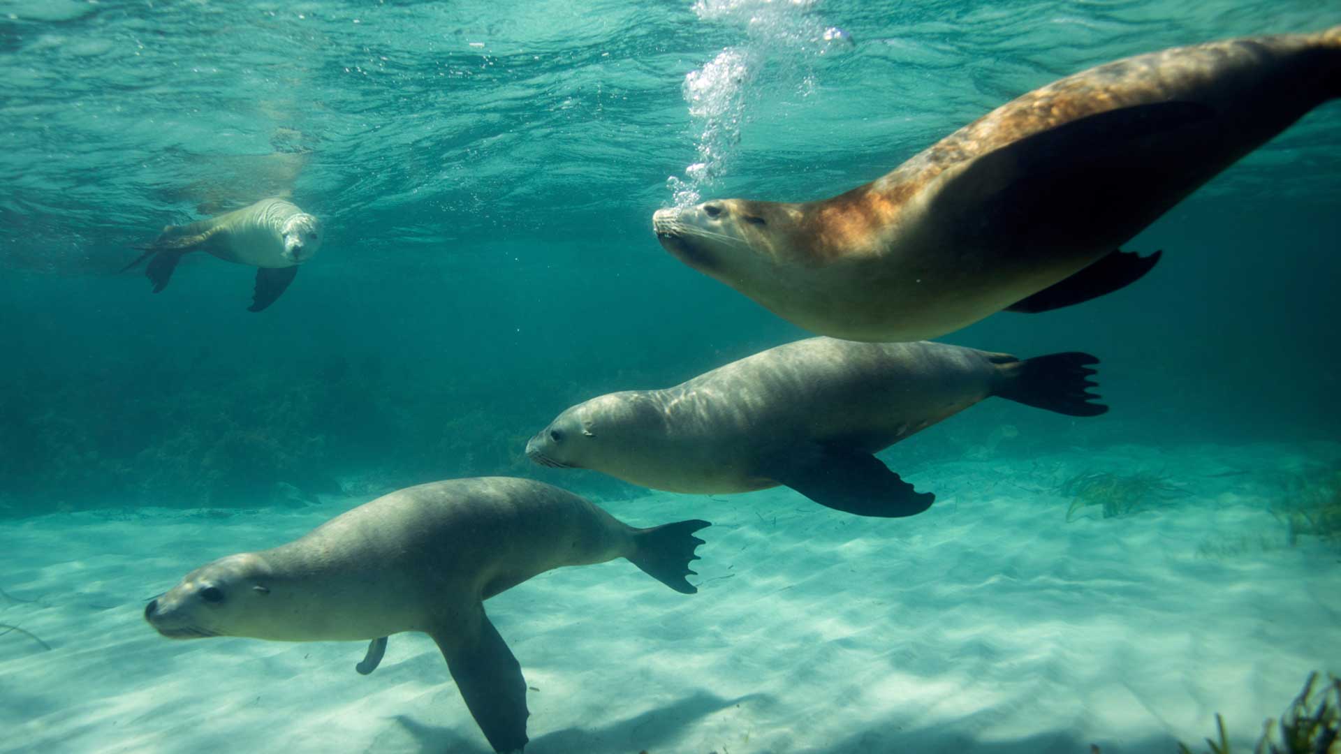
Australian sea lions are listed as endangered, with their numbers in the wild estimated as less than 12,000. Image credit: courtesy Kane Overall/South Australian Tourism Commission
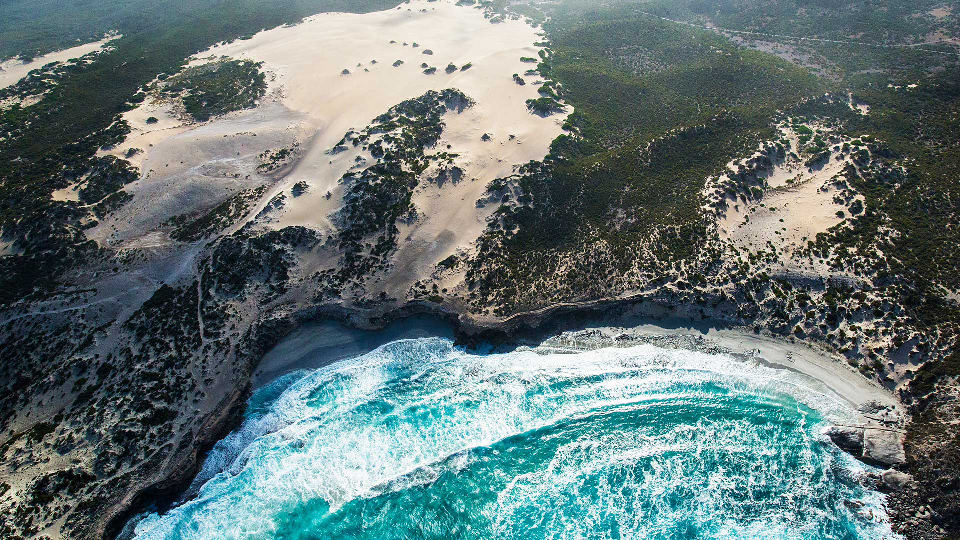
The Eyre Peninsula’s tip abounds in startling contrasts. The two huge hammerhead peninsulas, forming Lincoln and Coffin Bay national parks, jut to the east and west respectively. These geological wonders give the region an uncanny symmetry. Both sport natural harbours and discreet, hideaway bays. But each turns to the open ocean with wildly exposed cliffs and beaches – plus a slew of menacing reefs, islands and unyielding capes, not to mention freakish and unforgiving currents and relentless waves.
The Eyre Peninsula is part of the Gawler Craton, one of the most stable hunks of our continental crust. It’s home to some of Australia’s oldest rocks, dating back as far as 2.44 billion years.
This ancestry is reflected in the distinctive dome-like hills that dot the peninsula, as well as formations such as the Marble Range looming out of vast wheat paddocks north of Coffin Bay.
Meanwhile, along the foot of the coast, these crystalline-tough basement granites hold fast as robust headlands and broad, wave-cut terraces. This sturdy frontline takes the brunt of the ocean’s heaviest blows, and protects the much younger layers of limestone above. Born out of wind-blown calcareous dunes, this limestone caps vast areas of the coast and hinterland. Gracefully scalloped cliffs of pale, biscuit-coloured stone are the peninsula’s gritty signature.
With such an array of coastal haunts on their doorstep, it’s little wonder the lives of Port Lincoln’s 14,088 residents are so entwined with the sea. On any weekend, board-riders by the dozen are catching breaks at Sleaford and Fishery bays.
Meanwhile, across the peninsula, the waters of Boston Bay are flecked with cabin cruisers, tinnies and white sails of all sizes. In this port, regattas unfold against a backdrop of tuna boats toing and froing, and hefty bulk carriers loading grain.
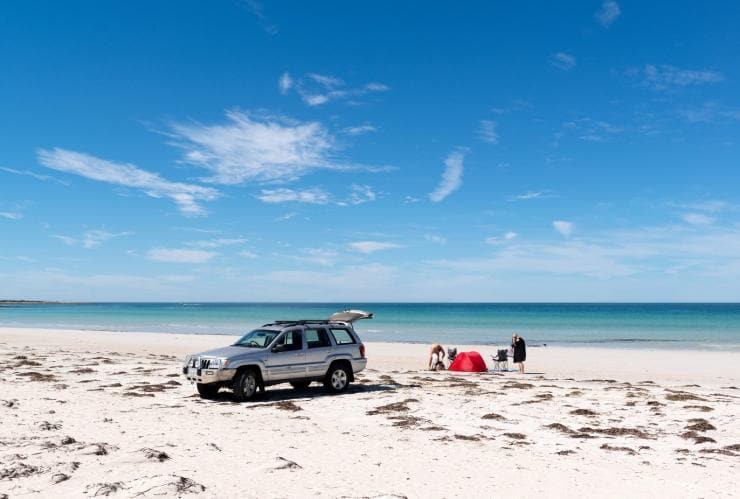
Even far-flung Memory Cove – hidden at the end of a rough four-wheel-drive track in a wilderness protection area – is a cherished hotspot for local campers and boaties. Indeed, despite its sombre back story, the cove has a bright, lively air. Birdlife abounds. In a few strides through the coastal mallee you can step from a world of New Holland honeyeaters, silvereyes and Port Lincoln parrots to the beachfront domain of hooded plovers and oystercatchers – with a white-bellied sea-eagle rarely far from view. It’s seventh heaven for twitchers.
To South Australians, the Eyre Peninsula is better known as the “west coast”. It’s talked about as a larger-than-life place that’s home to vast wheat farms, raging surf, sharks and sudden storms. The region’s grain harvest might be a whopping 2 million tonnes, but above all else the west coast is synonymous with big-time fishing.
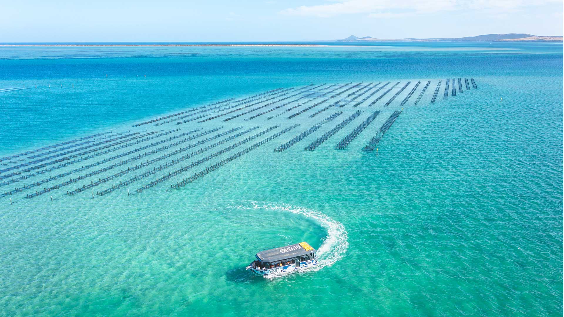
Tours of the oyster farms are a popular pastime for visitors to Coffin Bay. Image credit: courtesy Isaac Forman/Tourism Australia
Practical science, largely initiated by prawn-boat skippers and crews, strictly controls the where and when of trawling these days. With an annual prawn harvest hovering near 2000t, the gulf is one of the region’s star performers. In truth, the entire region boasts an astonishing bounty – from abalone and sand crabs to southern rock lobsters, known to South Australians as crayfish, mussels, scallops, oysters and a host of prized scale-fish species.
The Great South Australian Coastal Upwelling System brings cold, nutrient-rich waters billowing to the surface from the edge of the continental shelf. These dissolved nutrients are the foundation links in the marine food chain – including the pilchards that bluefin tuna feast on. Among the other beneficiaries are the famed oysters of Coffin Bay. This network of enclosed waterways is mollusc paradise. Clean waters and daily tides deliver all the necessary goodies for the area’s 40 or so oyster farmers.
With its jetties, waterfront shacks, caravan park and general store, Coffin Bay’s township is the quintessential laid-back fishing village. It’s a seafood frontier blessed with delicious coastal produce.
That kind of profusion applies equally to the patchwork of nearby Coffin Bay National Park. From the placid waters of Yangie Bay it’s a short drive to the cliff-top vistas at Almonta Beach. But the heart of the park spills westward past ephemeral lakes and tea-tree scrub to a widening peninsula. It’s a spine-shuddering ride by 4WD. As well as dune drifts to climb and waves to dodge on Seven Mile Beach, the inland tracks are so lumpy that drivers rarely graduate from second gear.
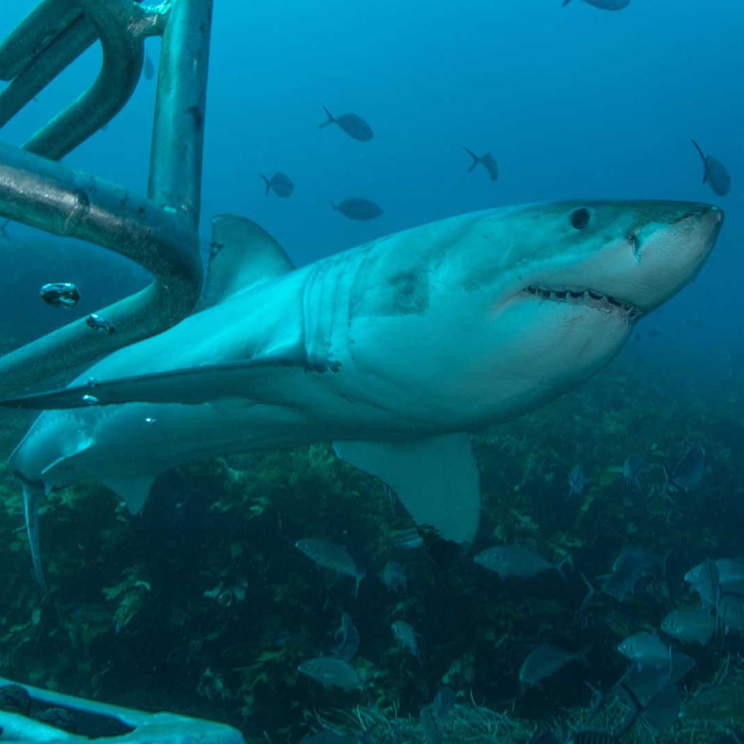
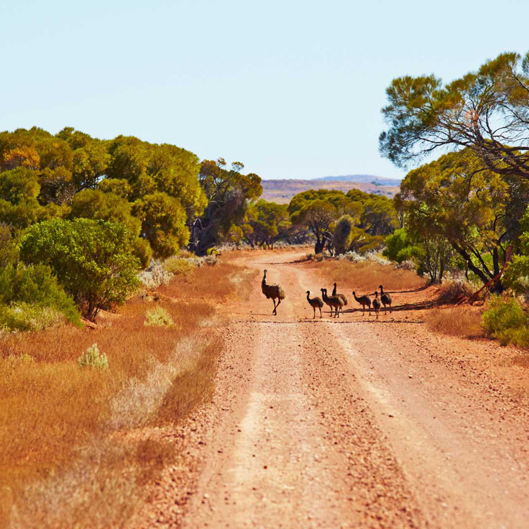
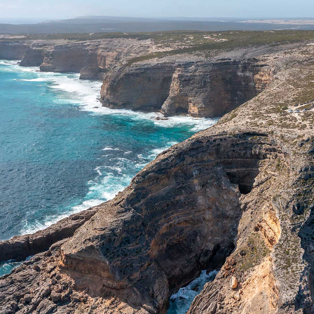
Image credits: (left-right) courtesy Adam Bruzzone/Rodney Fox Shark Expeditions; courtesy Maxime Coquard/South Australian Tourism Commission; Andrew Gregory
The feathery branches of the tall, drooping she-oaks in nearby grassy woodlands catch the breezes with a breathy sigh, while underfoot the ground is spongy, matted with fallen branchlets. Tucked amid the trees, the sea feels distant, yet in reality everywhere you go in this park, a restless coastal dune is rising somewhere on the horizon.
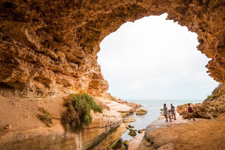
Walking along the limestone cliff tops of the Whidbey Wilderness Area involves dodging potholes and loose shards of rock. One hundred metres from the shoreline, one of the holes lets out a startling, throaty growl as air shoots skyward, forced up by sea water surging below. Then another does the same. Not content with battering the cliffs until they crumble like blocks of honeycomb, here the ocean literally tunnels under your feet to vent its anger.
From the secure footing of a lookout on terra firma, the landscape shifts are dramatic, even unnerving. But that’s nothing compared with the view from the deck of a small boat beneath cliffs in a pitching sea. Moreover, in certain conditions, even the most benign waters can become angry and treacherous. Then all it takes is a sudden punch of wind, a wrong move or a tidal rip for disaster to strike.
There’s no better place to contemplate the raw power of the Southern Ocean at work than Reef Point, in Coffin Bay NP’s south-west. Here a clutch of headlands and reefs faces the incoming barrage. Even the tenacious basement geology can’t stop the grinding impact of the elements on the 100m-tall limestone cliffs.
As darkness closes in, the light of a small fishing boat appears out to sea. With a storm front approaching, its crew is heading north for the safe haven of Coffin Bay. Its light sways with the swell until it recedes up the coast, vanishing behind a relentless haze of waves and spray.
How to Explore the Eyre Peninsula
Swap the crowds for wild landscapes, native wildlife and fresh-from-the-ocean seafood on the Eyre Peninsula. The continent’s most picture-perfect white-sand beaches, windswept sea cliffs and hidden coves front some of the biggest swells, making this a destination for thrillseekers and nature lovers alike.
With more than 65 per cent of the nation’s seafood, including green-lipped abalone, scallops, prawns, oysters and tuna, pulled from the surrounding water, it’s Australia’s major seafood hub.
THE ESSENTIALS
WHERE: Port Lincoln, near the south-eastern tip of the Eyre Peninsula, is 252km west of Adelaide.
WHEN: The weather is mild year-round, and it’s rarely busy, even during school holidays.
HOW: Fly into Whyalla, Port Lincoln or Ceduna and hire a car.
The drive from Adelaide is 680km and takes seven hours.
DON’T MISS: Swim with sea lions and dolphins in Baird Bay.