
Travel the Archipelago of the Recherche – a Brutal Coast
Words: Jessica Watson | Images: David Dare Parker
Leaping ashore from the dinghy and quickly scrambling up the steep white beach, out of reach of the surging waves and onto Middle Island, my first thought is that I’m lucky to be here.
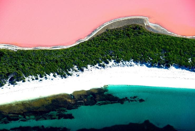
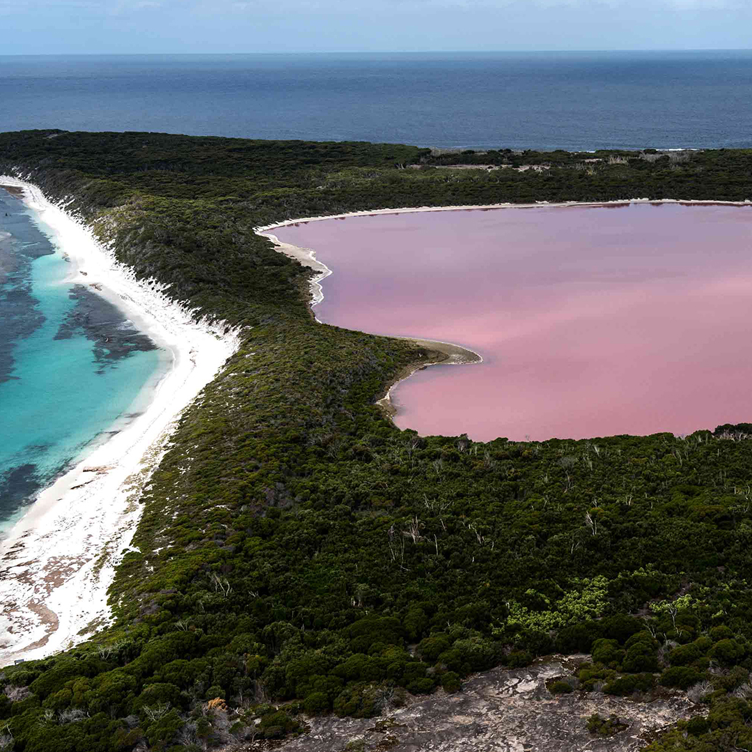
Aerial photos of the island’s most famous feature, a bright pink lake, are readily available online, but the island itself is far less accessible. Despite the frequent use of the images in tourist brochures, this destination is a long way off the average tourist’s beaten track.
As one of 105 islands and 1500 islets and submerged rocks that form the Archipelago of the Recherche, Middle Island sits off a remote and exposed stretch of Western Australia’s southern coastline, about 9 km from Cape Arid. Powerful Southern Ocean swells, a near-relentless wind, the lack of a nearby harbour or landing facilities and the requirement for hard-to-get access permits make just reaching this island an adventure in itself.
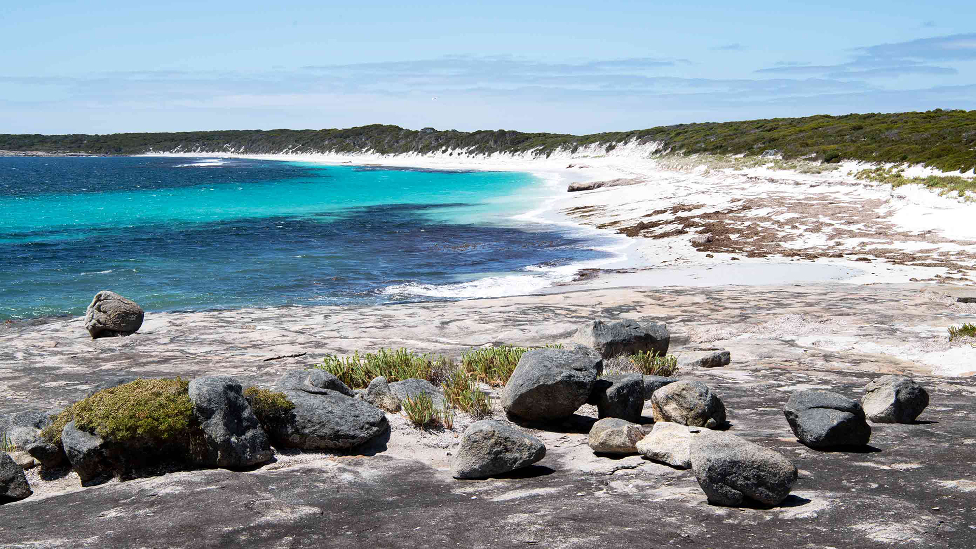
After drying our feet and pulling on shoes, our landing party – WA Parks and Wildlife Service officers Brendan Williams and Stephen Butler, photographer David Dare Parker and myself – sets off towards a rocky headland with views of the island’s longest beach, which is covered in the fine white sand for which this part of WA’s coastline is famous.
The area’s first known western visitor was Dutch sailing master Pieter Nuyts, documenting the islands in 1627. More thorough exploration and charting by Rear Admiral Bruni d’Entrecasteaux aboard the French ships Recherche and Esperance followed in 1792, while Matthew Flinders conducted surveys from 1802. Throughout the area’s maritime history, the hazardous nature of the region has claimed many ships.
The archipelago’s most recent significant wreck was the 33,000-tonne bulk carrier Sanko Harvest in 1991. Hoping to shorten her passage, the ship’s master strayed from normal shipping channels and grounded on Harvest Reef, 10 km south of the Australian mainland.
Shayne Starr, now skipper of a local charter boat, was in primary school at the time but remembers the day well. Despite early reports that salvage was possible with little environmental impact, rough seas and the ship’s movement against the reef saw it lose oil and its phosphate cargo. The local Esperance community rallied to assist the massive clean-up effort. Shayne recalls being pulled out of school and “sent to the beach to collect bags of oil”.
Back on Middle Island, Stephen, district nature conservation coordinator, leads us off the beach to a rocky clearing where the ruins of a fisher’s hut stand on a site that was likely used by sealers in the early 1800s.
Black Jack Anderson was the most notorious of these sealers. He was known to carry a brace of pistols and steal from shipwrecked sailors while based on Middle Island during the 1830s. To evade capture, he was reported to have crossed to the far side of the island to take refuge in a cave concealed at the base of the cliffs.
Reports of his wild band of followers, rumours of the wealth he amassed, and the dramatic island setting make it easy to see why he became notorious – he is Australia’s only known pirate. Over the years, Black Jack’s fame has flourished in the many retellings of his escapades, and in the wild theories of where his hypothetical treasure might be buried.
But, as Nyungar Elder Doc (Ron) Reynolds bluntly explains, the tale of Black Jack is “not a good story from an Aboriginal perspective” because of the women he kidnapped to enslave as concubines and wives. “He sort of had an aura around him at the time,” Doc says. “Men were scared of him”.
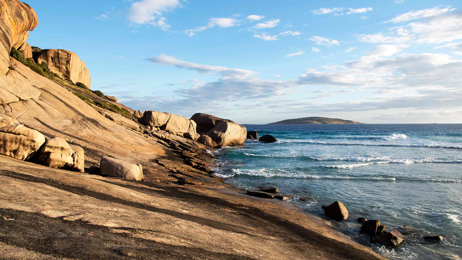
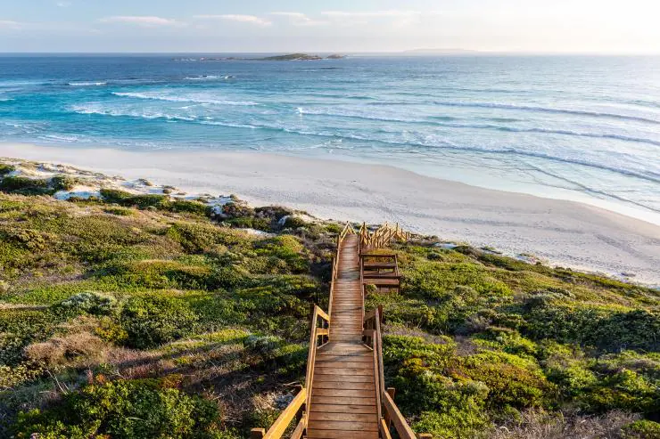
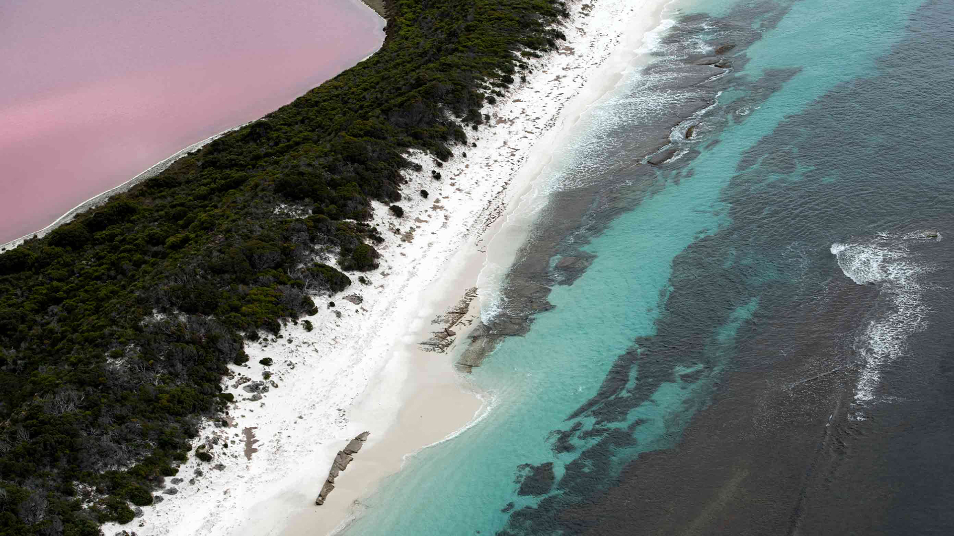
The mainland has many white sand beaches, but the archipelago’s islands are bordered mostly by hard bare granite like this West Beach headland near Esperance.
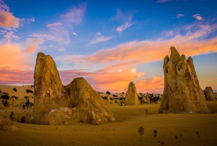
As we head further inland on Middle Island, the vegetation gives way to an expanse of open granite, typical of other Recherche islands, many of which are covered mainly in bare granite interspersed with occasional limestone structures. The granite here features a round gnamma waterhole, painstakingly hollowed into solid rock by First Nations people. Doc, who’s not only the proprietor of the popular Esperance coffee van Lucky Bean, but also a cultural researcher with a fascination for the archipelago’s history, explains that the early inhabitants would have made the hole to collect and store rainwater about 5000 years ago, before Middle Island was separated from the mainland.
The track beyond the open granite becomes heavily overgrown with vegetation that slows our progress to a crawl, and almost obscures the remnants of old stone dwellings and a well. These are thought to have been constructed as a base for early sealers and whalers, or as part of the salt-mining venture that was briefly established on the island from 1889 to 1890.
Finally, a little further along the track, the island’s famed pink lake becomes visible through the dense scrub. A fresh wind covers the surface in small ripples and the strong pastel colour doesn’t disappoint.
Stephen Butler says the lake is a unique feature of the archipelago and that its online celebrity is proving to be a challenge, with growing requests for access threatening the delicate ecosystem.
“I don’t think we should stop visitation, but we need to control and restrict it,” he says, explaining that people can’t be allowed to walk into it. “There’s a salt crust on the lake, they’ll break that, stir up sediments and we don’t know how that would affect the chemistry”. He says that a pink lake in South Australia lost its colour because people were entering it.
Stephen explains that the lake gets its distinctive colour from high salt loads in the water. “The salt concentration is maybe eight or 10 times higher than that of sea water and in the [lake] water, you’ve got a bacterium that produces beta-carotene, which essentially acts as a pigment”.
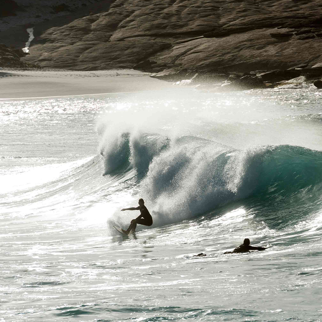
With the wind freshening through the afternoon, our return voyage from Middle Island to the mainland isn’t smooth. We pass rocky outcrops that send spray flying high into the air, submerged or semi-submerged reefs that create perfect curling breakers and patches of icy blue turbulence that vividly contrast the surrounding deep blue ocean. One of these submerged reefs, in certain conditions, produces the infamous and unpredictable Cyclops surf break, which includes waves considered to be among the world’s largest and heaviest, surfed only by the the most daring and experienced.
Stephen, whose extreme sporting hobbies indicate athleticism and an appetite for adventure, describes the difficulties of landing on such exposed islands. He explains that during seal surveys conducted by the WA Parks and Wildlife Service in 2001, he and his team had to swim onto several survey locations. “A lot of the islands are just rocky slopes,” he says. “You can’t land a small boat on them, so you’ve got to get in the water off the back of the boat and swim the last 20m.” This certainly wasn’t without risk. “There’s a technique to it,” he adds. “If the swell is too big you have to be realistic about it.”
They also had to be wary of sharks while in the water. An offhand comment made by local Esperance Museum volunteer Don Fiercey provides me with a sobering illustration of the area’s reputation as a great white shark haven: “Saw a big fella the other day – longer than a 17-foot boat,” he says.
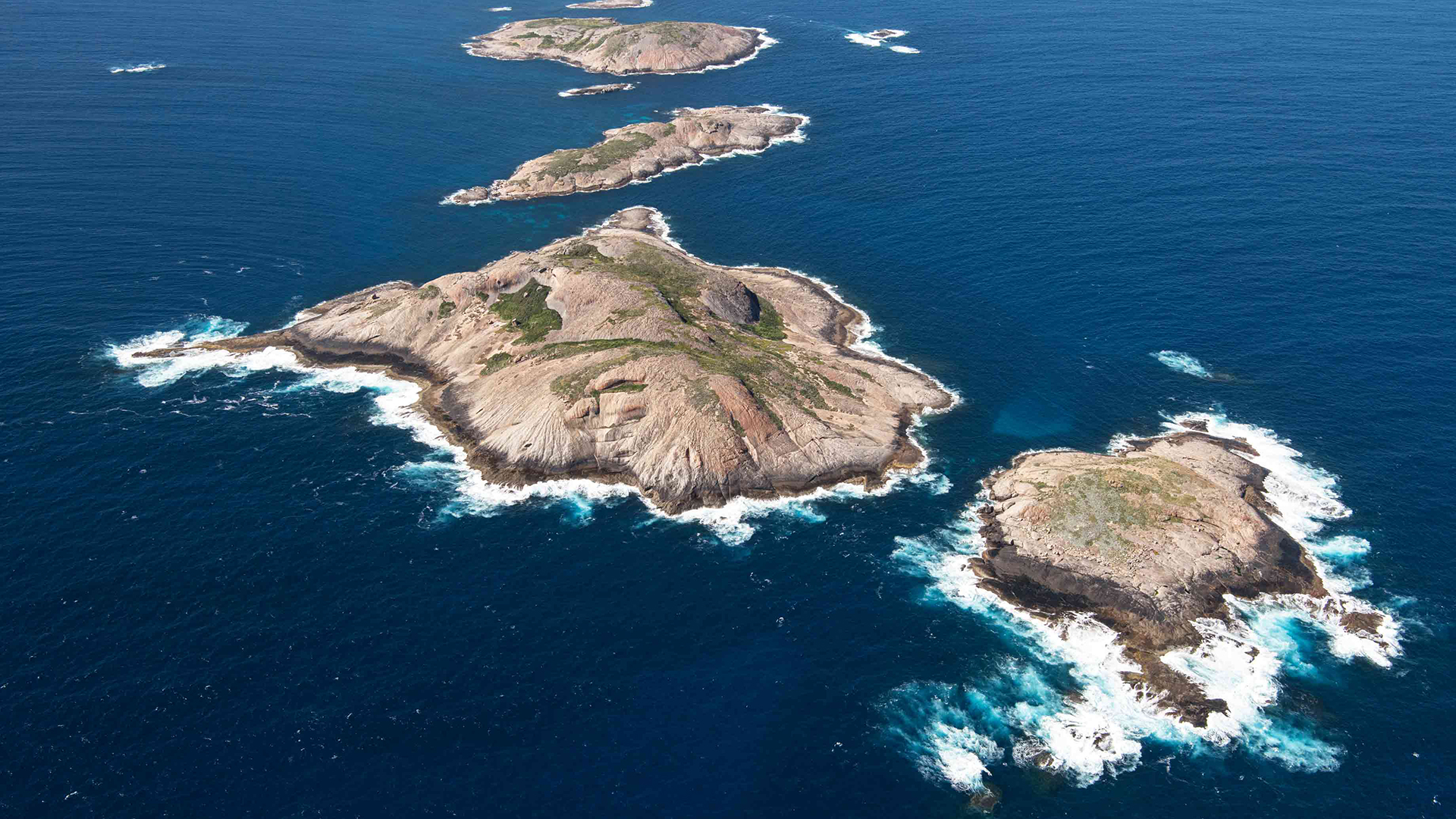
The scale of the archipelago and the inhospitable nature of its many bare or sparsely vegetated granite islands can be truly appreciated when viewed from above.
Back on the mainland, the coastline itself is an attraction featuring stunning beaches covered in squeaky white sand. The most famous is Lucky Bay, about an hour’s drive east of Esperance, in Cape Le Grand National Park. The idyllic beaches strike me as somewhat at odds with the harshness of the region’s rugged headlands and wild conditions.
In Esperance, there’s no denying the town’s close connection with water. Its port, southern Australia’s deepest, can handle ships of 200,000 tonnes. A handful of large bulk carriers anchored just off the coast is visible from The Esplanade, the road that skirts the coast.
I see the islands from another perspective via the family home of environmental engineer Shelley Payne. Some southern Recherche islands are visible through the windows as Shelley explains her involvement in an Australian Geographic Society-supported project on Salisbury Island, one of the archipelago’s most remote locations.
“We really want to do as much non-invasive research as possible”, Shelley says. Although the research team’s investigations cover the island’s endemic population of black-flanked wallabies, New Zealand fur seal colony, a nearby shipwreck and potential Indigenous artefacts, it is their work studying the island’s great white shark hotspot that draws the most attention. “There’s a congregation there at certain times of the year”, she says.
A second expedition takes me to the accessible Woody Island, about 15km off the Esperance coast. The late Don Mackenzie, an Esperance tugboat operator, first offered tours here to subsidise the cost of his tugboats, before establishing Woody Island as a family destination in 1974.
In what Malcolm ‘Fud’ Mackenzie, one of Don’s sons, describes as the “golden years” between 1995 and 2005, the island saw as many as 16,000 visitors a year. Woody Island remained empty for a number of years after that but has now reopened. Fud explains that his father had a long-held affection for the place.
“He was the last person to graze sheep there”, Fud says. “Dad really loved Woody Island. He could always see the attraction”.
On the island, there is a view of the jetty, and of distant whitecaps, islands, and the mainland beyond it. It’s easy to understand Don’s fondness for the place.
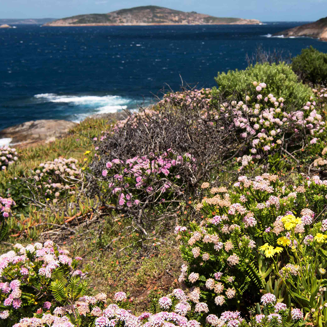
A handful of short bushwalks weave between a stand of western she-oaks, providing views across the surrounding striking blue waters and fields of succulent herbs, dotted with bright flowers covering the rocky cliffs. The island, one of the most heavily vegetated in the rugged archipelago, feels like a haven, protected from the harsh conditions and far from civilisation.
How to Explore the Archipelago of the Recherche
With its uninhabited islands, dazzling white beaches, reefs and azure waters, the Archipelago of the Recherche is truly a picture-postcard paradise as well as a mecca for wildlife. Scattered off the southern coast of Western Australia, the archipelago’s 105 islands and 1200 rocky outcrops are home to colonies of sea lions and fur seals, pods of dolphins and a rich diversity of birdlife. It’s a sometimes surreal landscape that can be the perfect weekend getaway. But there are many other mainland locations that are worth visiting in this part of WA.
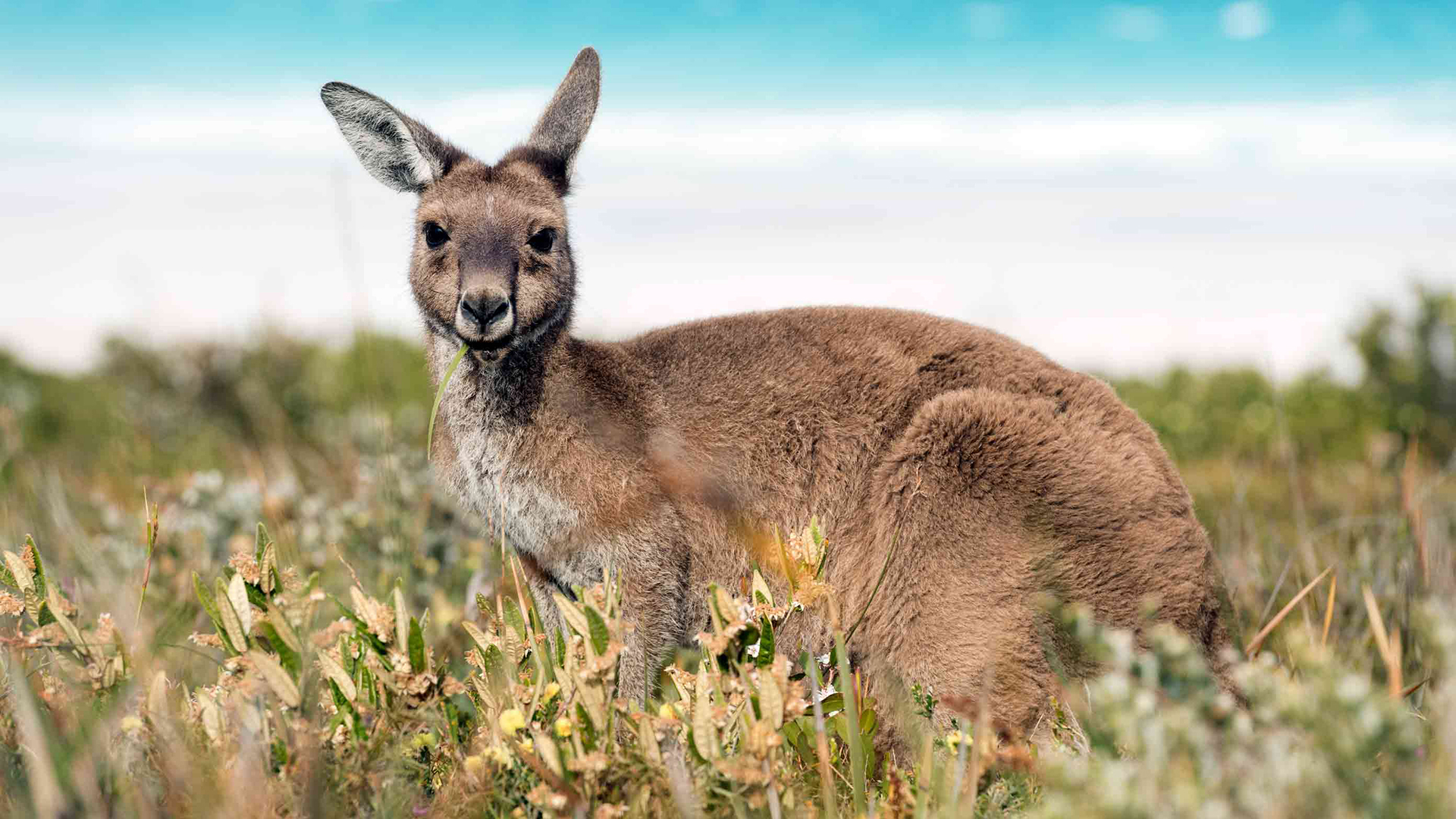
Lucky Bay is famed for its white sands and inquisitive population of western grey kangaroos.
THE ESSENTIALS
WHERE: The Archipelago of the Recherche lies approximately 50 km off the coast of Esperance, southern WA.
WHEN: Most visit during the dry summer months.
HOW: From Esperance, hop on a ferry to Woody Island. If you want to explore the entire archipelago, opt for scenic flights or a wildlife cruise.
DON’T MISS: The migrating southern right and humpback whales between July and October.
More pink lakes
The famed pink colour of Lake Hillier, on Middle Island in WA’s Recherche Archipelago, is due to a pigment produced by algae that survive in the hypersaline water.
It’s an algae called Dunaliella salina, paired with a bacteria called halobacteria, that turns lakes pink. These hypersaline environments are found across Australia, and their colour and intensity change throughout the year depending on season, cloud cover, weather and even time of day. Here are some of Australia’s best pink lakes and when to visit them.
Lake Hillier
Australia’s most famous pink lake is also its most inaccessible. The Archipelago of the Recherche’s Middle Island is now closed to the public, but you can take a scenic flight over the bubble-gum pink lake, which is vibrant all year round. At 600m wide and 250m long, Lake Hillier is small but packs a punch.
Lake MacDonnell
A day’s drive from Adelaide is Lake MacDonnell. Extreme salt concentration makes it one of Australia’s most intensely coloured pink lakes. Drive or walk across the causeway that slices into the landscape, with its striking contrast of pink on one side and blue and green on the other. Visit in May to September to see it at its most vibrant.
GUIDED Hutt Lagoon
Roughly five hours north of Perth lies Hutt Lagoon, a pink lake that stretches over 7000ha. Depending on cloud cover, the colour varies from bright pink to lilac. On a clear day, its colours are most vivid 10am–2pm. Avoid visiting in summer when the lagoon usually dries out and loses its colour.