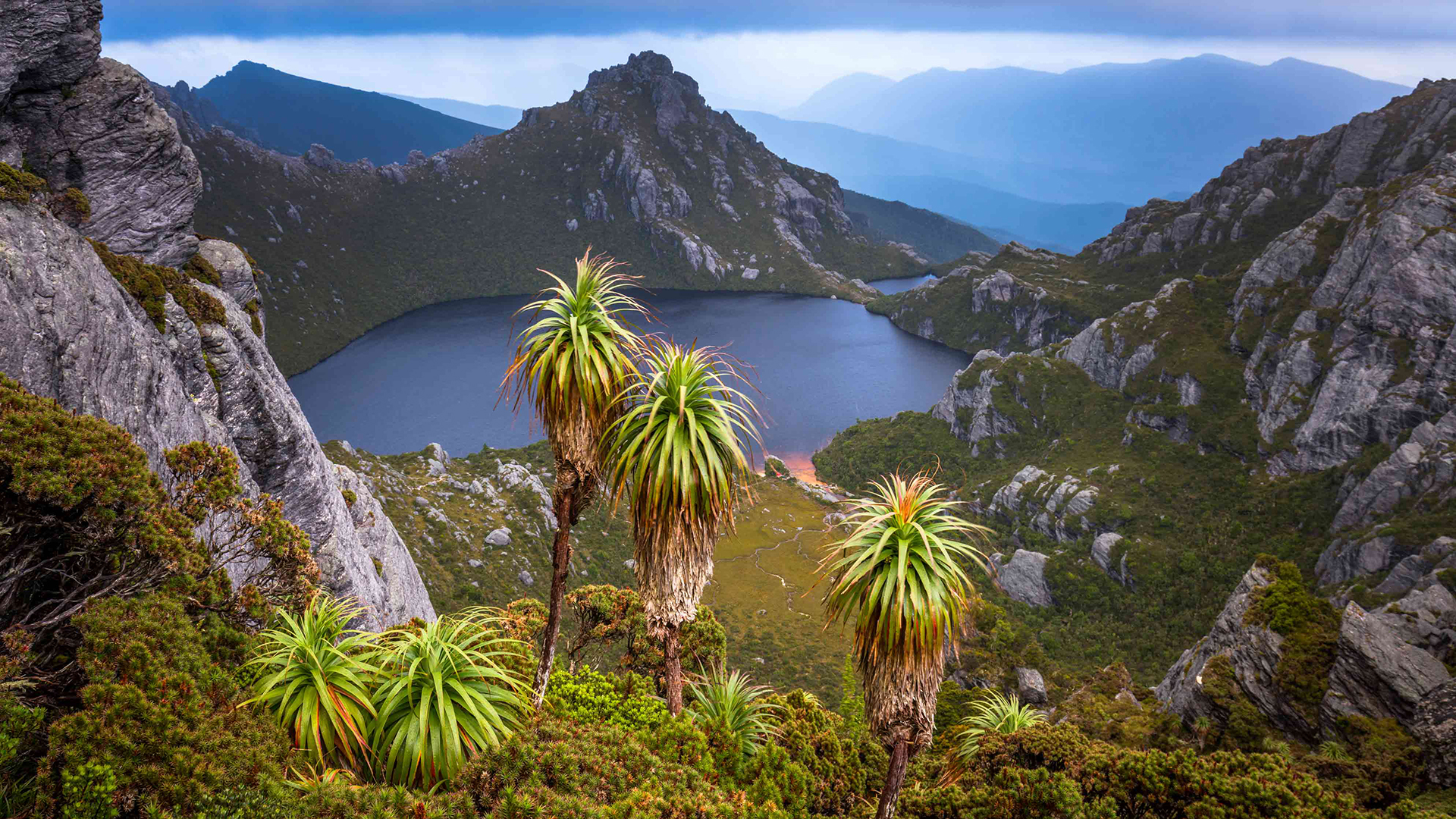
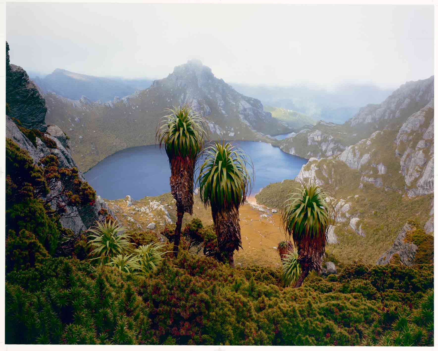
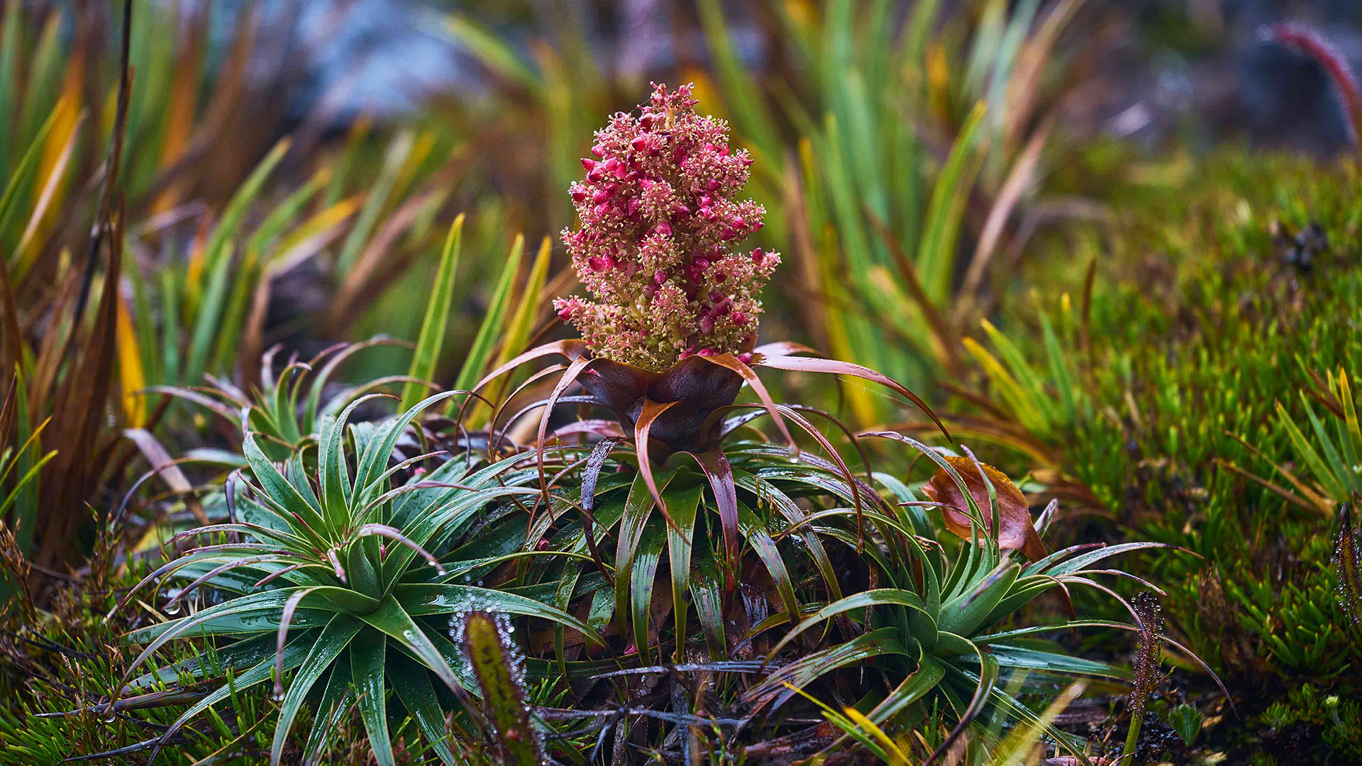
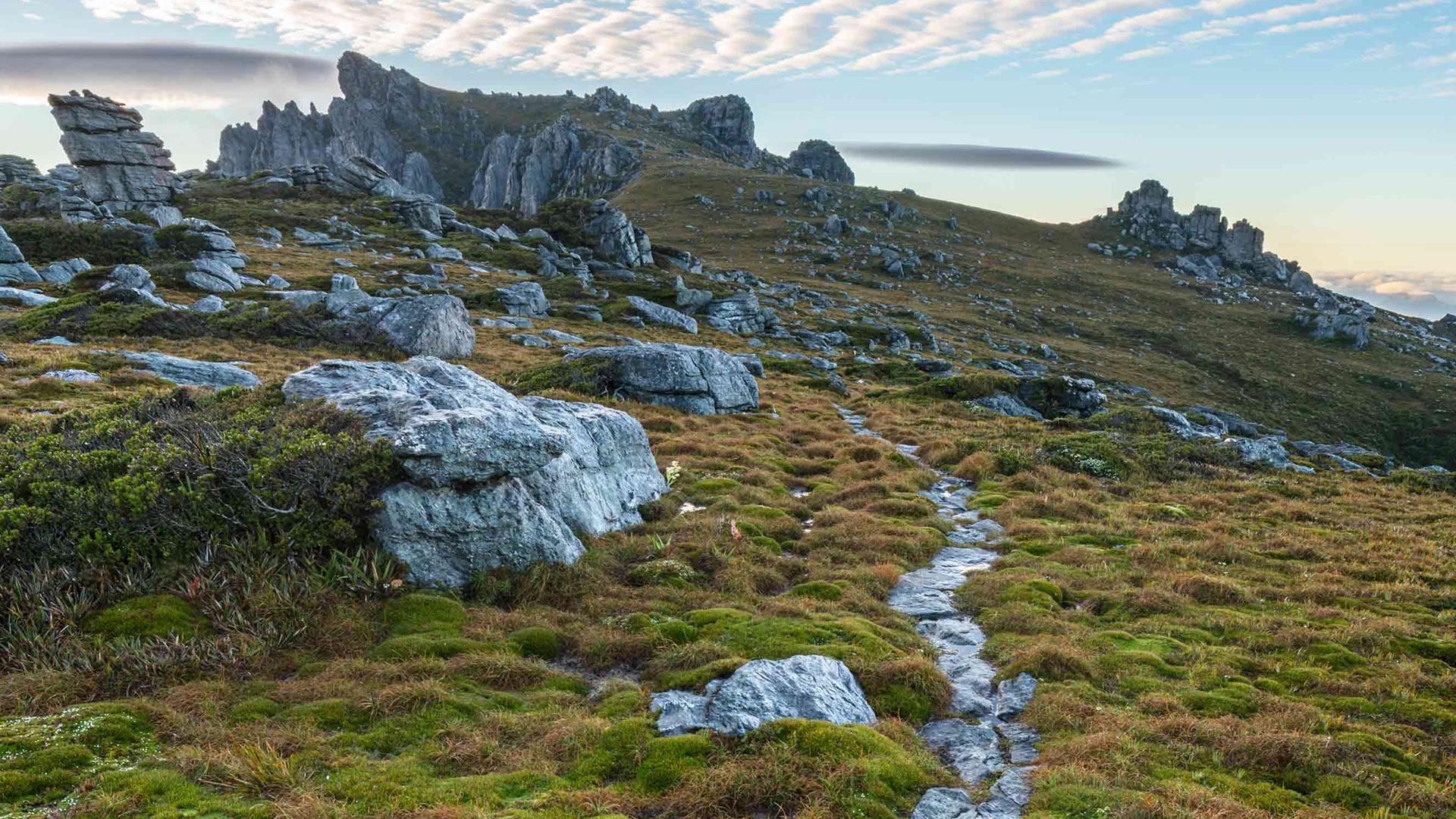
Travel Tasmania – Tassie’s Magical Wild West

Words: Tim Wrate | Feature image: Luke Tscharke

My legs screamed and my back ached from the weight of my heavy pack as I clambered up the steep, rocky track to the saddle between Mt Orion and Mt Sirius in Tasmania’s remote Western Arthur Range. Finally, Lake Oberon came into view. Impossibly beautiful, this mist-shrouded body of water hangs weightlessly between the mountains, as though floating magically in the sky. Upon seeing it, the feelings of foreboding I’d been experiencing since ascending into the range from the Arthur Plains below immediately gave way to a sense of calm. 

I realise what a profound moment this is for me. I have spent years imagining what it would be like to see this scene. Ever since I first viewed the late Peter Dombrovskis’s famous photograph of the lake (below), taken in 1988, I’ve felt compelled to visit this incredible place, not only to witness the rugged beauty of the ancient landscape, but also to pay respect to one of Australia’s greatest wilderness photographers.

Images taken by Peter Dombrovskis, such as this iconic shot of Lake Oberon in the Western Arthur Range, brought Tasmania’s wild and beautiful landscapes to the attention of the world and led to the introduction of new protective measures. Image credit: courtesy estate of Peter Dombrovskis

Lake Oberon is hidden deep in the Western Arthur Range, in Southwest National Park, about 90km south-west of Hobart. The range, which cuts above the surrounding plains like the serrated edge of an immense saw blade, is only 30km long, but still manages to contain a tangle of 22 major peaks, 30 lakes and countless crags, cliffs and tarns. 

It is protected as part of the Tasmanian Wilderness World Heritage Area, which covers about one-fifth of the island state and is made up of a series of national parks, conservation areas and reserves. 

Matthew Flinders provided the first documented account of the Western Arthur Range, which he sighted during his circumnavigation of Tasmania aboard the Norfolk in 1798. 

“The mountains which presented themselves to our view in this situation, both close to the shore and inland, were amongst the most stupendous works of nature I have ever beheld and it seemed to me are the most dismal and barren that can be imagined,” Flinders wrote in his journal. “The eye ranges over these peaks, and curiously formed lumps of adamantine rock, with astonishment and horror.”

Carved from quartzite, the jagged outcrops certainly are a sight to behold. Rising abruptly from the button grass plains, they jut into the sky like pillars. 

Studded with glacial lakes, the landscape features spectacular evidence of glaciation, including expansive moraines and hanging valleys. 

The dramatic scenery of the range attracts about 400 walkers each year. And now I was one of them. With fellow landscape photographers Dylan Toh, Francois Fourie and Luke Tscharke, I set out to experience the majesty of the Western Arthur Range and try to capture its beauty through my lenses.

We planned a six-day hike along part of the Western Arthurs Traverse, a 72km track that loops through the range from Scotts Peak Dam. 

Widely regarded as one of Australia’s most challenging multi-day walks, the tricky traverse is known for its arduous ascents and vertigo-inducing descents. 

Tim (left) and Francois paused before descending the 1119m-high Mt Hayes, one of the last places photographed by Dombrovskis before he died of a suspected heart attack while shooting in this same mountain range in 1996. Photographs of Mt Hayes were in the camera found with his body. Image credit: Luke Tscharke 

With a mixture of nerves and excitement, we began our journey at the Scotts Peak Dam car park. Weighed down by packs laden with provisions, camping equipment, cameras, lenses and tripods, we set off on the boardwalk through the scrub towards the button grass plains that would eventually lead us to the looming peaks.

The boardwalk quickly gave way to a boggy track that we squelched along for hours. Some sections were so muddy we found ourselves knee-deep in thick sludge that tried to suck the boots off our feet with every step. 

Our mud-hopping slog was a slow and exhausting start to the journey, but the plains eventually opened up, offering us spectacular views of the peaks. It was motivation to push on. 

As we closed in on the Western Arthur Range, it became easy to see the effects of glaciation. Moraines cascaded down the flanks of the mountains and large quartzite boulders littered the area, having been deposited some 11,000 years ago.  

From the foot of the range, the track ascends Alpha Moraine, which rises almost 800m, providing a relentless, heart-pounding climb for bushwalkers.  

The feathery branches of the tall, drooping she-oaks in nearby grassy woodlands catch the breezes with a breathy sigh, while underfoot the ground is spongy, matted with fallen branchlets. Tucked amid the trees, the sea feels distant, yet in reality everywhere you go in this park, a restless coastal dune is rising somewhere on the horizon.

Walking along the limestone cliff tops of the Whidbey Wilderness Area involves dodging potholes and loose shards of rock. One hundred metres from the shoreline, one of the holes lets out a startling, throaty growl as air shoots skyward, forced up by sea water surging below. Then another does the same. Not content with battering the cliffs until they crumble like blocks of honeycomb, here the ocean literally tunnels under your feet to vent its anger.

From the secure footing of a lookout on terra firma, the landscape shifts are dramatic, even unnerving. But that’s nothing compared with the view from the deck of a small boat beneath cliffs in a pitching sea. Moreover, in certain conditions, even the most benign waters can become angry and treacherous. Then all it takes is a sudden punch of wind, a wrong move or a tidal rip for disaster to strike. 

There’s no better place to contemplate the raw power of the Southern Ocean at work than Reef Point, in Coffin Bay NP’s south-west. Here a clutch of headlands and reefs faces the incoming barrage. Even the tenacious basement geology can’t stop the grinding impact of the elements on the 100m-tall limestone cliffs. 

As darkness closes in, the light of a small fishing boat appears out to sea. With a storm front approaching, its crew is heading north for the safe haven of Coffin Bay. Its light sways with the swell until it recedes up the coast, vanishing behind a relentless haze of waves and spray.

Much of the flora of the region, such as this Richea alpina (short candle heath), is stunted due to the often extreme alpine conditions. There are just 11 species in this genus, and nine of them are found only in Tasmania. Image credit: Luke Tscharke 

Parts of the Western Arthurs track have been constructed by Tasmania Parks and Wildlife Service staff using local stones, which help stop erosion of this fragile area. The track from here winds past Mt Hesperus.. Image credit: Luke Tscharke

Tags: