
Travel Pilbara – Rock of Ages
Words: Karen McGhee | Images: Nick Rains
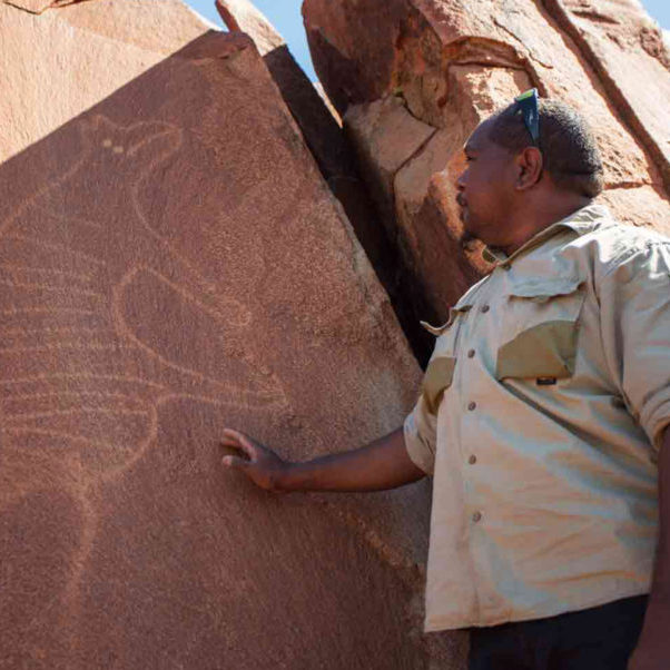
At first, it’s difficult to see the images Geoffrey Togo is pointing out in the landscape. Then you spot one, reset your line of focus and they start popping out everywhere: emu toes and turtle eggs; kangaroo profiles; human stick figures wearing headdresses. Suddenly you’re surrounded and have to stop dead in your tracks, worried about stepping on something significant.
We’re standing in Deep Gorge on the southern end of the Burrup Peninsula, near the north-west Australian coastal town of Dampier, at the edge of a vast outdoor art gallery. Geoffrey is a Ngarluma Elder and senior cultural ranger with the Murujuga Aboriginal Corporation (MAC), and this is one of Australia’s most significant Indigenous sites – the planet’s oldest and largest concentration of petroglyphs. Known as Murujuga to local Indigenous language groups, the Burrup is covered by chips, chunks, boulders and slabs of intrusive igneous rocks. These crystallised from molten magma trapped deep in the continental crust 2.7 billion years ago.
Their surfaces have been weathered to dark reds and greys, but digging at them exposes lighter tones and they’ve been used as a medium for at least 1 million petroglyphs: a patiently etched body of work created by thousands of artisans across at least 30,000 years. But the site is more than a huge expression of creativity. Here, the Elders explain, are life’s rules and guidelines, as relevant to current generations of Pilbara language groups as they were to their ancestors. Because of its geology, the peninsula is a permanent historical record and enduring instruction manual on cultural practice for this area and beyond.
Much of the peninsula and adjacent Dampier Archipelago, which is also rich with cultural sites, has been protected since 2007 on the National Heritage List. WA’s Aboriginal Heritage Act 1972 provides protection and, last year, almost half the peninsula was gazetted within Murujuga National Park. The 4913 ha site – WA’s 100th national park – protects an area of significant ancient and living cultural heritage, and is the state’s first park to be managed jointly: the Indigenous owners working with the WA Parks and Wildlife Service. The land is owned in freehold by MAC, which represents Ngarluma-Yindjibarndi, Yaburara- Mardudhunera and the Woon-goo-tt-oo language groups, and leased back to the state.
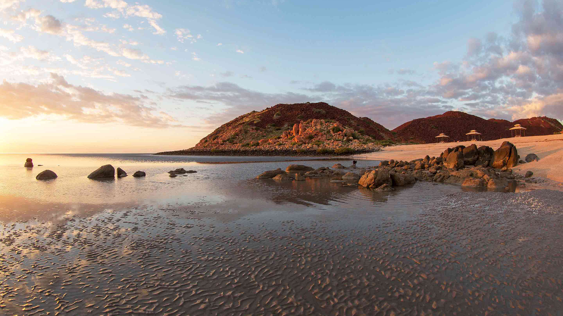
There’s no avoiding the red dust of the Pilbara’s rusting rocks. It coats the landscape, infiltrates your clothes and hair and clads your skin, its metallic aroma rising with the morning’s heavy dew.
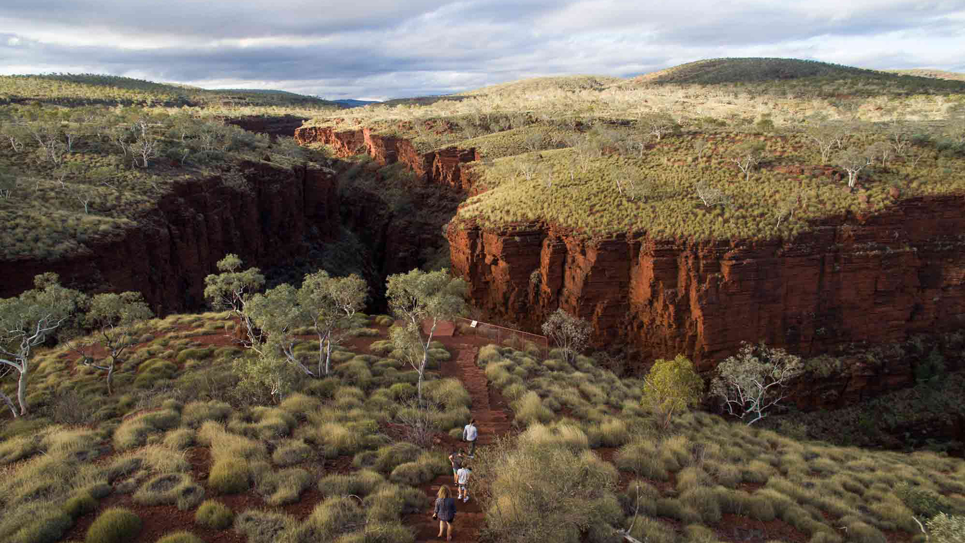
These rocks contain the huge iron-ore deposits that have underpinned the region’s economic development since the 1960s. Geologically, they’re ancient layers rich with quartz and iron ore known as banded iron formations (BIFs) that were deposited as silt, mud and clay up to 3.2 billion years ago around the edges, and floor of primordial oceans. Their alternating stripes of iron-rich red separated by black, grey and sometimes even blue or green shales and cherts adorn the Pilbara like massive geological artworks. And they form a row of hills, the Hamersley Range, that run for almost 500 km.
The Pilbara’s BIFs lie over one of the oldest, most intact sections of Earth’s crust: the mostly granite and greenstone Pilbara Craton, which is thought to have formed 3.6 billion years ago – not long after Earth’s formation.
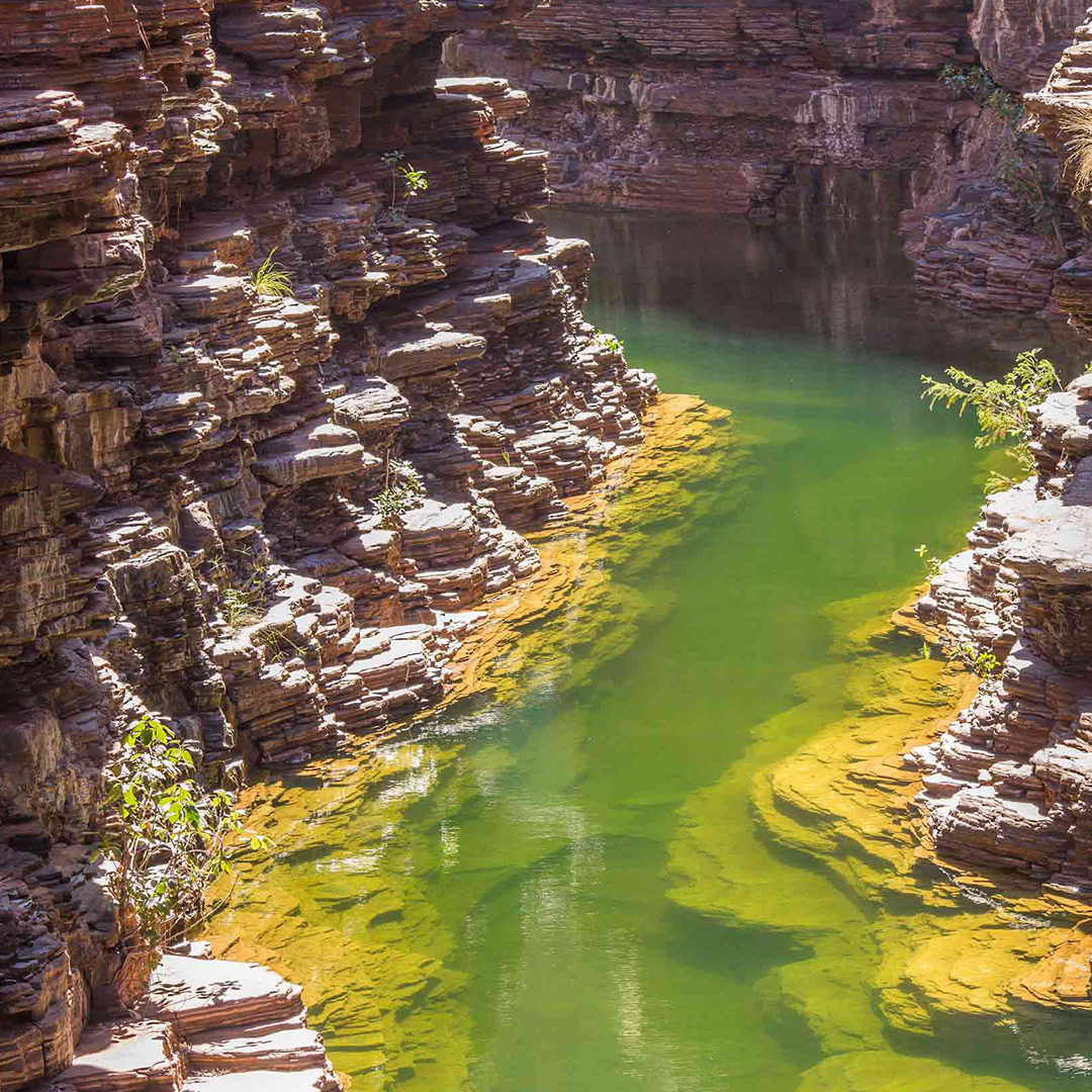
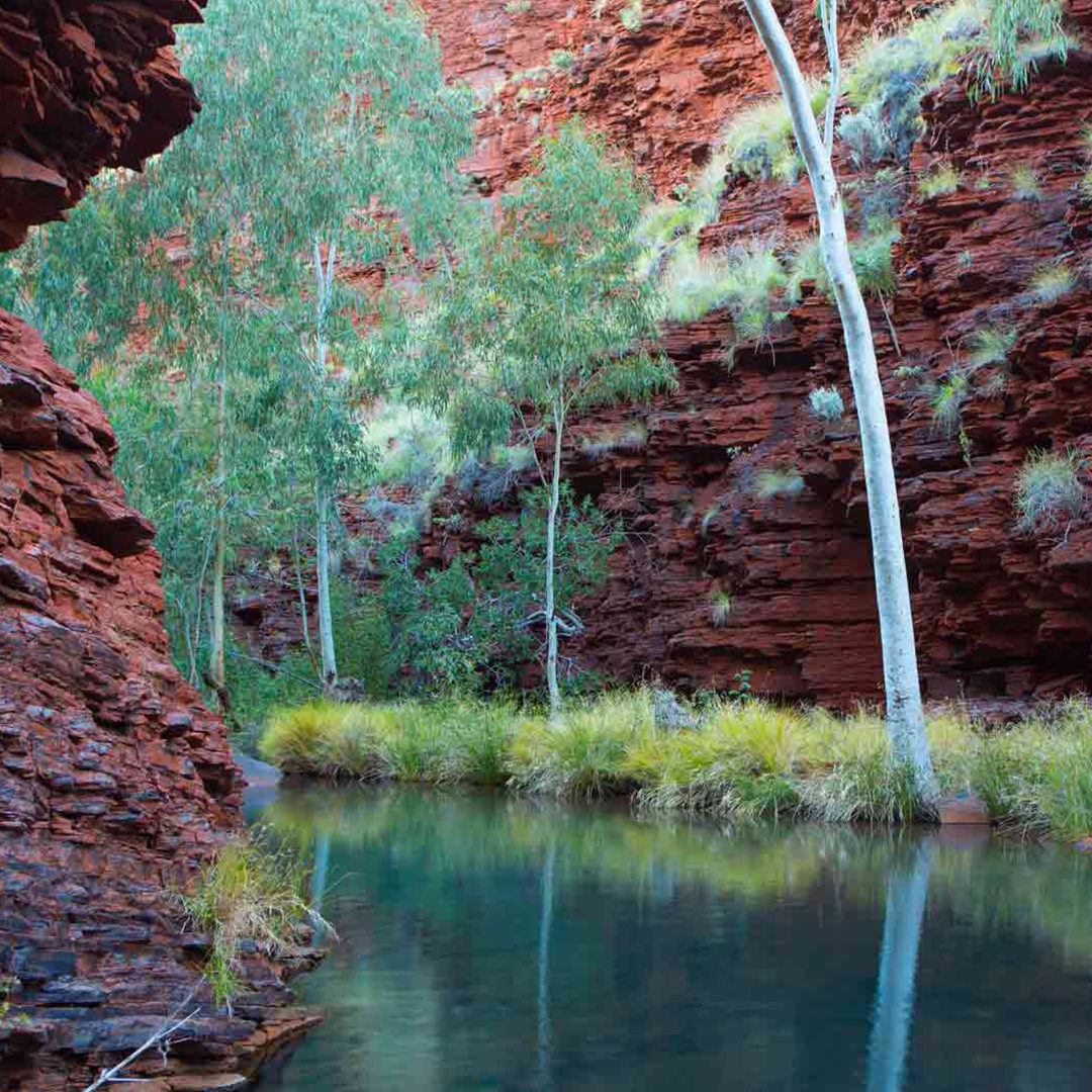
More than 300 km from the Burrup and two-thirds of the way towards the Pilbara’s eastern limits lies Karijini National Park which, despite being one of Australia’s most remote parks, is among WA’s most visited outside of Perth’s metropolitan area.
The 6274 sq.km park attracts more than 200,000 people every year. Many of them come from elsewhere in Australia and overseas but the park is also used by an increasing number of locals, says Steve Berris, one of Karijini’s four rangers.
“Yes, it’s remote but we’re smack bang in the middle of the engine room of Australia’s mining economy”, he explains, referring to the region’s multibillion-dollar iron-ore mining industry. “We’re surrounded by what are called ‘mining camps’, but they’ve got airports to fly workers in and out, and each of them can have a few thousand people [at a time]. So we’ve got many thousands of people living and working within a 100 km radius of the park and we’re a very popular destination on their rostered days off”.
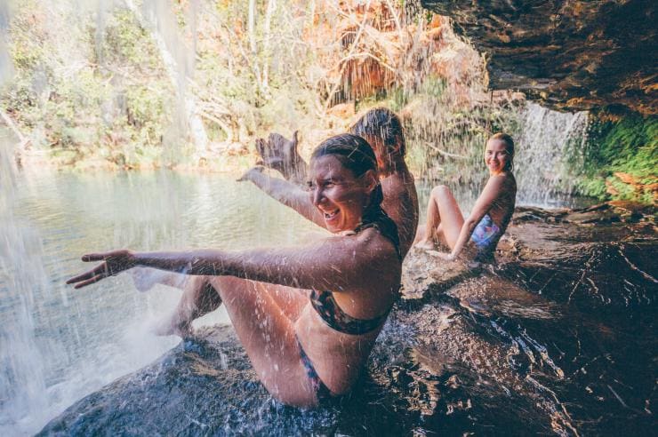
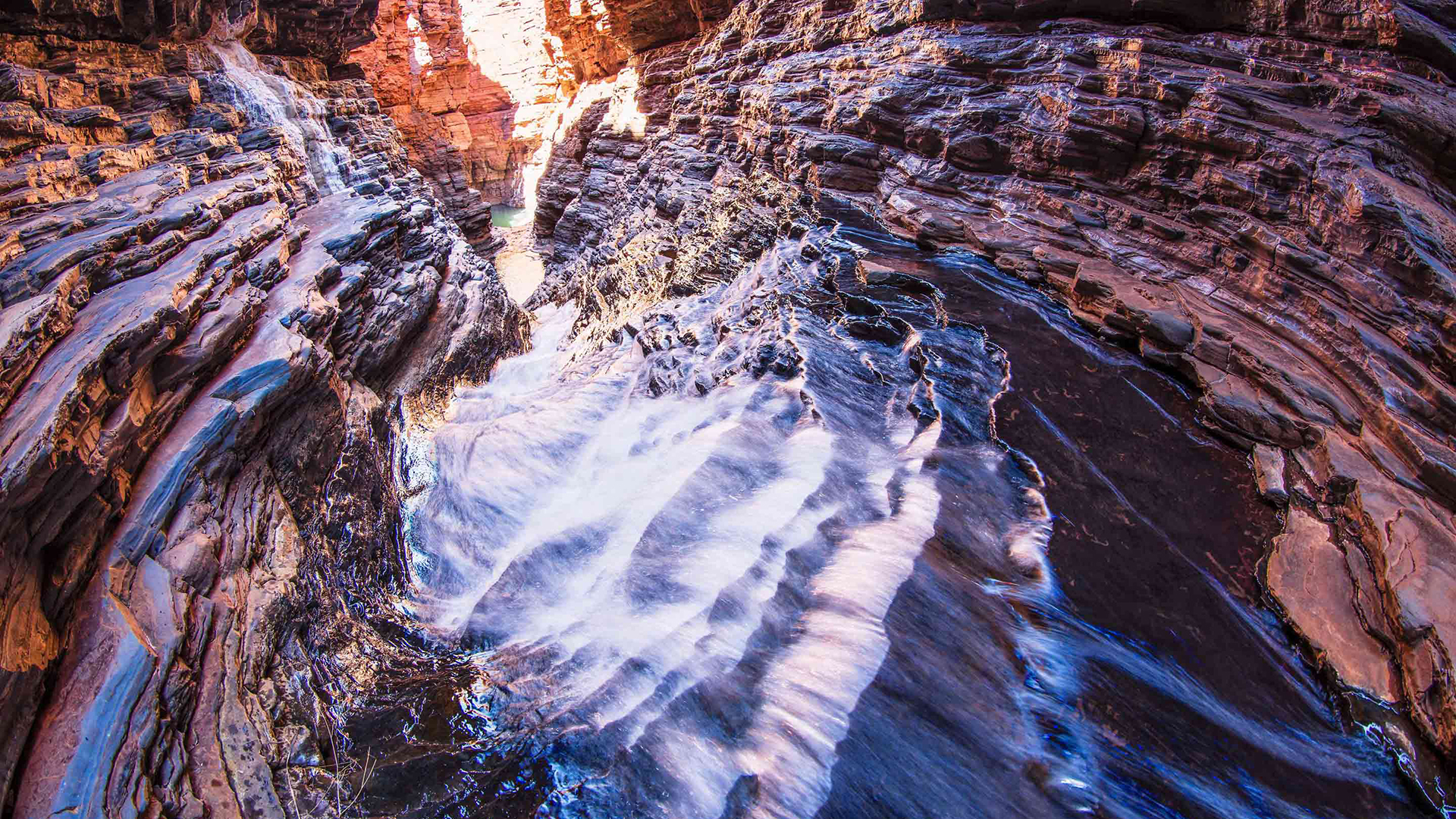
Most of the visitors are attracted by the spectacular water features in the park’s northern section: plunging gorges, cascading waterfalls, icy streams and rock pools carved from the BIFs by the erosive force of water over aeons.
Beyond its waterways, Karijini is a spectacular semi-arid landscape dominated by grey-green spinifex and the rich-red mounds of termites – the basis of most food chains out here.
Like Murujuga, Karijini has deep cultural significance. Karijini means ‘hilly place’ to the people of the area, explains Maitland Parker, an Elder with the local Banjima group, and refers not only to the national park but all the Hamersley Range.
Maitland was the park’s senior ranger for some 25 years but now works as a cultural awareness consultant for the big mining companies operating in the Pilbara, teaching mutual respect to CEOs as well as workers. Aged in his 60s, he has witnessed extraordinary change for his people here during his lifetime: from the ration camps, reserves and settlements of the 1960s and 70s into which different language groups were herded like cattle, to a Pilbara where profits are shared and culture is acknowledged, respected and considered.
“Aboriginal people say, ‘Look that’s my Country, that’s my Yurlu. And in there, I abide by my laws that have been put down by the Mingala [god]’”, Maitland explains to the miners and their bosses. “So when Christian people talk about God, Jesus and everything else, we’ve got that same type of belief.
“Mingala gave us everything and put it in the Country and so we abide by all those laws and customs that have been put down there”.
Cultural awareness was, says Maitland, forced on the mining industry but is now accepted as part of a change for the better, and respect for the region’s Indigenous heritage is growing. Local Pilbarans – both blackfella and whitefella – will tell you, with a wink, to be careful about the red dust getting into your veins, which is, of course, impossible. But there should be a warning about it infiltrating your soul.
How to Explore The Pilbara
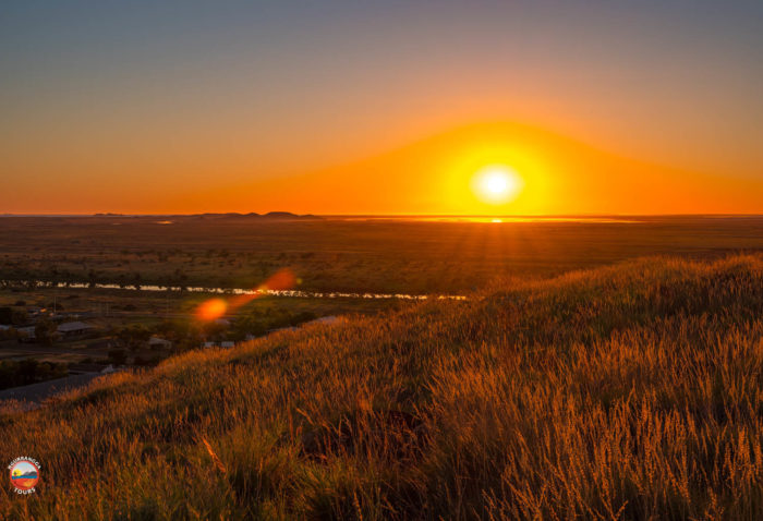
The Pilbara has some of the world’s oldest natural landscapes and many deeply spiritual First Nations cultural sites. Encompassing 200,000sq.km, the region stretches from a coast harbouring ancient human art to an ochre-red inland cut by gorges and waterfalls.
There’s no avoiding the red dust of the Pilbara’s rocks, which contain the huge iron-ore deposits that have underpinned the region’s economic development since the 1960s. It coats the landscape, infiltrates your clothes and hair and clads your skin. Some say it even seeps into your soul.
THE ESSENTIALS:
WHERE: A long way from anywhere! The Pilbara is in the north of WA, a 1300 km drive from Perth. It stretches from the west coast to the border of the NT.
WHEN: There are two seasons – the Wet (November to April) and the Dry (May to October). Conditions are mildest during the latter, and getting around is also safer and easier.
HOW: There are good-quality sealed roads from all directions, but most visitors fly into Port Hedland or Karratha, or catch a coach from Perth.
DON’T MISS: The Staircase to the Moon: This extraordinary natural phenomenon occurs along the Pilbara–Kimberley coast, year-round. As each full moon rises across the north-west coast’s tidal flats it creates the illusion of a staircase rising skywards.